X
The Trans Canada Trail is the world’s longest recreational trail network that stretches 28,000 km coast to coast. Also known as the “rails-to-trails,” the Trans Canada Trail is a multi-use trail developed along abandoned railroad tracks and is situated on the traditional territory of the First Nations, Metis, and Inuit peoples.
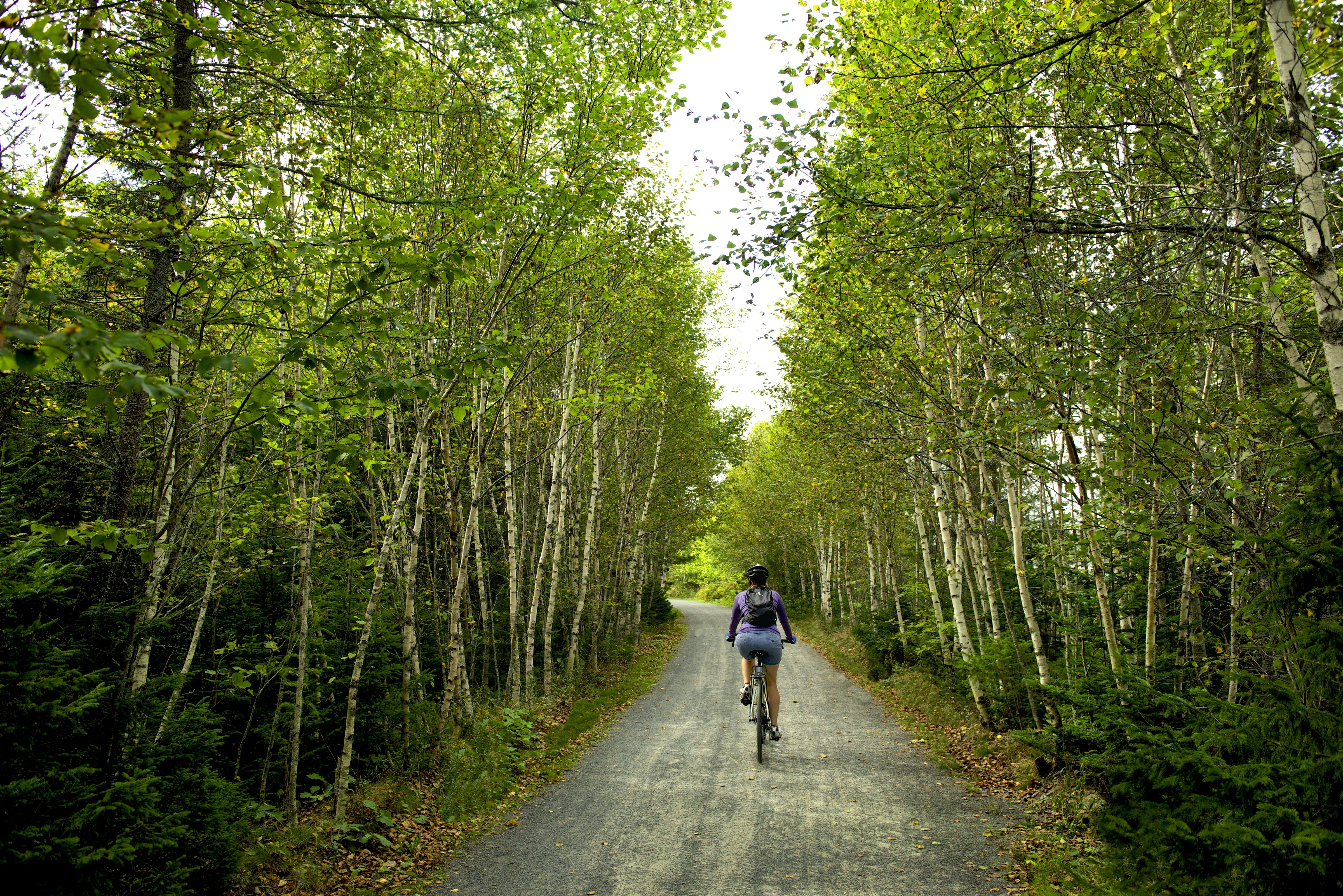
The Halifax region has many kilometres of rails-to-trails to explore that wind through urban, rural, and wilderness landscapes. Most of the trails are hard-packed crusher dust surfaces perfect for cycling, walking, running, and even walking with strollers. This guide will provide an overview of what to expect on each trail within the Halifax region, how to access the trail, nearby cafes to stop and refuel, bike rentals, and parking.
Explore the Trans Canada Trail interactive map.
Rent a bike to explore the trail:
Train Station Bike & Bean - Upper Tantallon
Scotia Cycle - Hubbards
Freewheeling Adventures - Hubbards
Pedal & Sea Adventures - Black Point
St. Margaret’s Bay Rails to Trails
Length: 33km
What to expect: This popular trail is part of the well-known Rum Runner’s Trail along the South Shore of Nova Scotia. There are spectacular views of St. Margaret’s Bay, dense forests, opportunities to glimpse wildlife, and a place to stop for a swim as you pass through Jerry Lawrence Provincial Park. While the trail is mostly flat, expect a few hills that lead to great lookoff points of the bay. It passes the Train Station Bike & Bean and Cavicchi’s Meats in Tantallon, which are great places to stretch your legs and refuel with a coffee and snack.
Access: Merges onto the BLT Trail in Hubley and the Aspotogan Trail in Hubbards. Parking at Train Station Bike & Bean and along Station Road in St. Margaret’s Bay and in Hubbards.
BLT Trails (Beechville, Lakeside, Timberlea)
Length: 13km
What to expect: The BLT Trail is also part of the Rum Runner’s Trail and winds through the sprawling suburban communities of Beechville, Lakeside, and Timberlea. The BLT trail crosses old railroad bridges and winds past several quiet lakes, which are the perfect opportunity to enjoy bird watching or solitude in nature.
Access: Merges onto the Chain of Lakes Trail and St. Margaret’s Bay Rails to Trails. Please note that to continue onto the St. Margaret’s Bay Rails to Trails, you’ll need to cross a section of the St. Margaret’s Bay Road. Picnic tables are located throughout the trail. Access to the Bluff Wilderness Trail System. Find parking at 22 Lakeside Park Dr or where the St. Margaret’s Bay Trail begins.
Chain of Lakes Trail
Length: 7.24km
What to expect: This paved asphalt trail connects Halifax to the BLT Trails and beyond. It winds through a few partially wooded areas and through the industrial shopping and business district of Bayers Lake Business Park. The trail is well-marked with signs and benches along the way. Refuel with a coffee at the 5K Café in Bayers Lake.
Access: Connects to the BLT Trail, St. Margaret’s Bay Trails, and Rum Runner’s Trail. The main parking lot is in Bayer’s Lake across from the 5k Café, or begin your cycle from Joseph Howe Drive in Halifax.
Shubie Canal Greenway
Length: 9.25km
What to expect: The Shubie Canal Greenway is a popular trail for walking, running, and biking. It passes through the historic Shubie Canal, several lakes, and through densely forested areas. Explore the history of the Shubie Canal at the Fairbanks Interpretive Centre along the way.
Access: The trailhead is located at Fairbanks Centre Shubie Park, 54 Lock Road, Dartmouth, just off of Waverley Road. Parking is also available at the Lake Banook Canoe Club Parking Lot.
Shearwater Flyer Trail
Length: 8km
What to expect: A secluded crusher dust trail with moderate tree coverage the entire way. The trail is mainly flat, with benches throughout to stop and rest. This trail is less busy compared to the adjoining Salt Marsh Trail and can offer a quieter experience.
Access: The Shearwater Flyer Trail begins in Dartmouth and connects to the popular Salt Marsh Trail in Cole Harbour. Parking at Hines Road, Caldwell Road, and at the Salt Marsh Parking Lot on Bisset Road.
Salt Marsh Trail
Length: 6.7km
What to expect: The Salt Marsh Trail is an extremely popular and scenic trail along the old Musquodoboit rail bed. It offers spectacular views of the water and shallow wetlands and excellent opportunities for viewing coastal and migratory birds. There are benches along the way to sit and enjoy the scenery and interpretive panels of local history and ecology. Part of the Cole Harbour – Lawrence Coastal Heritage Provincial Park, this trail is ideal for walking, biking, cross-country skiing, snowshoeing, fishing and bird watching.
Access: Connects to Shearwater Flyer Trail in Cole Harbour and the Atlantic View Trail in Lawrencetown. Main parking lot on Bisset Road.
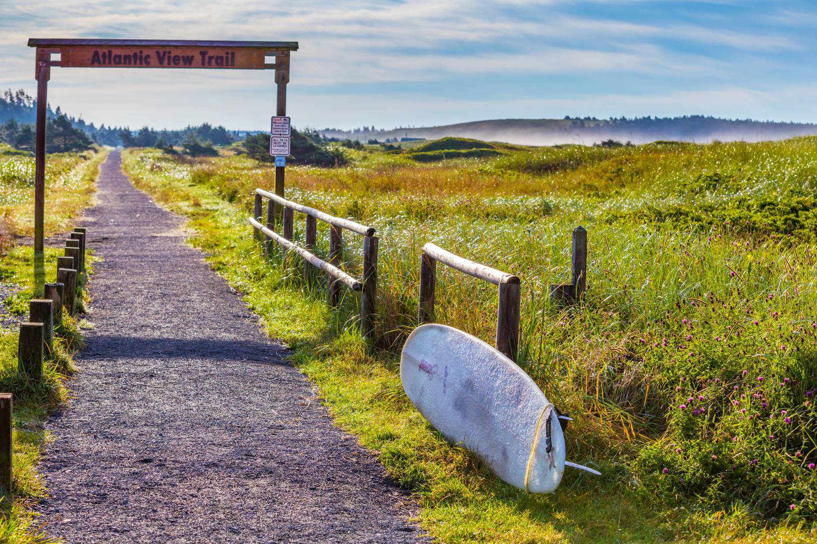
Atlantic View Trail
Length: 10.4km
What to expect: Part of the Cole Harbour – Lawrencetown Coastal Heritage Provincial Park, The Atlantic View Trail is a stunning coastal greenway with views of salt marshes, headland bluffs, beaches and dense coniferous trees. Stop for a swim at Lawrencetown Beach on your way through. Lawrencetown Beach Café is a great place to rest and snack on some locally grown treats and coffee.
Access: Connects with the Blueberry Run Trail and Salt Marsh Trail. Parking lot at Lawrencetown Beach.
Blueberry Run Trail
Length and location: 12.8km
What to expect: Blueberry Run Trail is a rugged, narrow stretch of the Trans Canada Trail primarily used by ATVs. This trail is not well maintained for cycling or walking, and many rocks and uneven surfaces are along the trail.
Access: Runs from Seaforth to Chezzetcook. Connects from the Atlantic View Trail. Note: this trail does not connect directly onto the Gaetz Brook Greenway.
Gaetz Brook Greenway
Length and location: 7.4km
What to expect: The Gaetz Brook Greenway is a relatively new section of the Trans Canada Trail. It follows an abandoned rail bed extending from East Chezzetcook through Gaetz Brook to Musquodoboit Harbour. Beautiful vistas, canopies of mature trees, natural vegetation, and plenty of places to stop and enjoy the view make the greenway an excellent walking, running or cycling path. The trail includes three trestle bridges that cross over Chezzetcook River, Gaetz Brook, and Rogers Brook where there are opportunities for fishing or birdwatching. See how many of the giant carved wooden owls you can spot placed throughout the trail.
Access: There are four accessible parking lots: 24 Debras Way; Gaetz Brook Legion; Gaetz Brook Junior High; and Stat Hill Rd, 7422 Highway 7. There are two fully accessible outdoor washrooms along the trail. This trail does not connect directly to any other trails along the Trans Canada Trail.
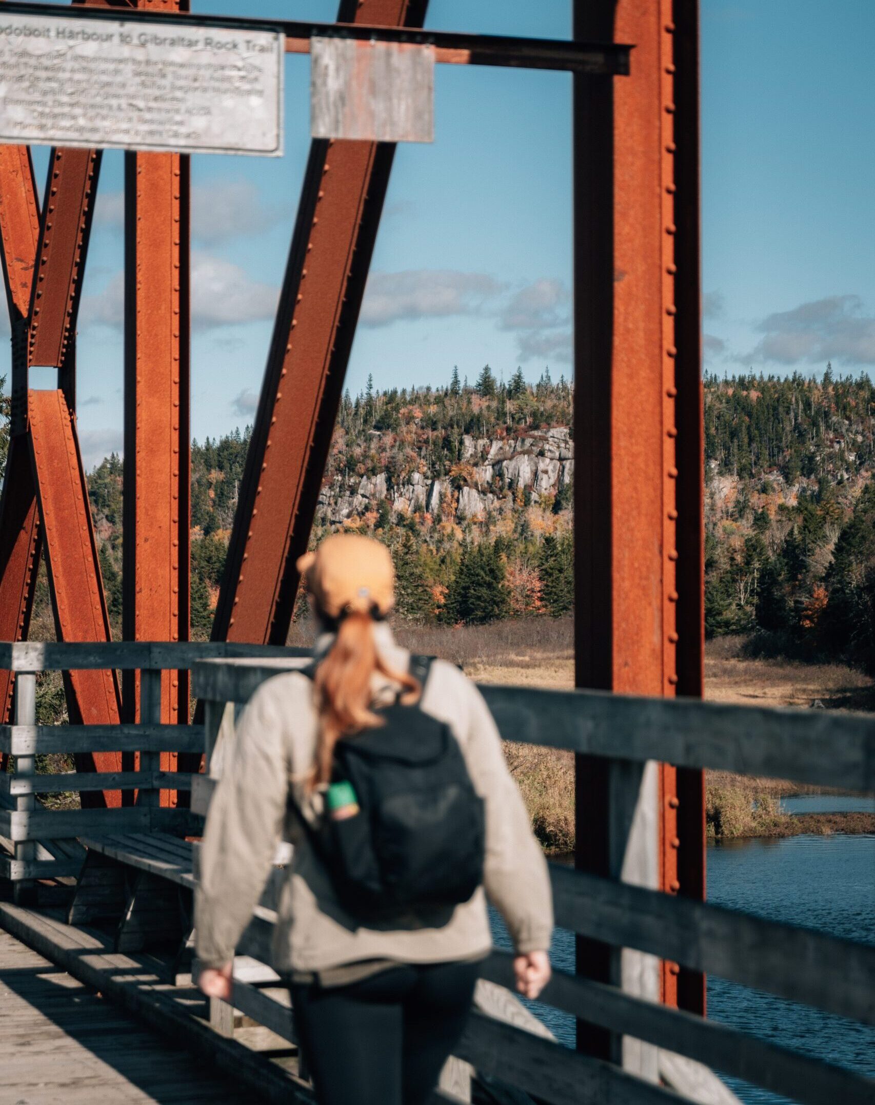
Musquodoboit Trailway
Length: 15km
What to expect: The Musquodoboit Trailway was one of the first designated sections of the Trans Canada Trail in Nova Scotia. The trail begins at the Caboose Information Centre at the Musquodoboit Railway Museum or at the main Trailway parking lot on Park Road. A 130-foot trestle bridge offers scenic views of the Musoquodooit River and marshy flood plains. There are many backcountry & wilderness trails that connect from the Musquobodoit Trailway, including the popular Gibraltar Rock Trail and Admiral Lake Trail. Grab a to-go snack from Martinique Desserterie or Uprooted, or cool off with ice cream from Polar Bear Express in the summer months.
Access: Parking is available at the Park Road trailhead in Musquodoboit Harbour or at the Musquodoboit Railway Museum.